Enawo and Blanche are the names of two tropical cyclones that are currently located over the South Indian Ocean. Enawo formed over the last days east of Madagascar and north of Mauritius. It is forecast to intensify and to track southwestward toward Madagascar during the next two days. The Joint Typhoon Warning Center is expecting maximum wind gusts of up to 135 knots (about 240 km/h) on Monday, 06 March 18 UTC. With slightly lower intensity, tropical cyclone Enawo is forecast to make landfall in north-eastern Madagascar on Tuesday, 07 March 18 UTC. There is a risk of a storm surge, damaging winds and flooding. Especially along the east coast of Madagascar, where the tropical cyclone is expected to bring torrential rain of more than 300 mm until Wednesday.
As forecast in yesterday’s post, the tropical low north of Darwin (Australia) intensified to tropical cyclone strength over the last 24 hours. Tropical cyclone “Blanche” is forecast to track southwestward and to make landfall on the north Kimberley coast on Monday. Damaging wind gusts and strong rain are possible over the western Top End and in the Kimberley region during the next two days. For latest warnings see here.

Latest GFS forecast for Toamasina (Madagascar).
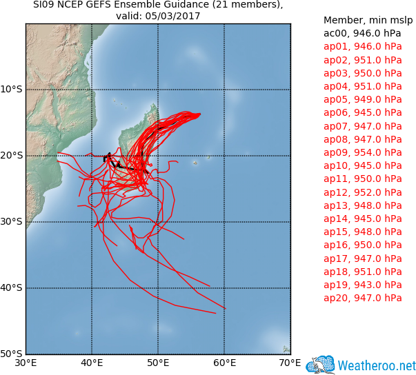
Latest GEFS track forecast for tropical cyclone Enawo.