Tropical cyclone Debbie has intensified to a category 4 cyclone. Its eyewall will soon pass across the Whitsunday Islands (see radar image below). Hence, it will be the strongest system to make landfall along the east coast of Queensland since tropical cyclone Marcia in February 2015. The weather station at Hamilton Island is reporting wind gusts of up to 196 km/h and more than 80 mm of rain over the last 24 hours (http://www.bom.gov.au/products/IDQ60801/IDQ60801.94368.shtml). The cyclone will cross the coast in the next 18 hours south of Bowen. Associated with the system are destructive winds of more than 200 km/h. It will bring heavy rain of more than 100 mm/day and rainfall totals of up to 500 mm along the coast, but also in inland areas. This may cause severe flash flooding and mudslides. After landfall the cyclone is expected to weaken rapidly.
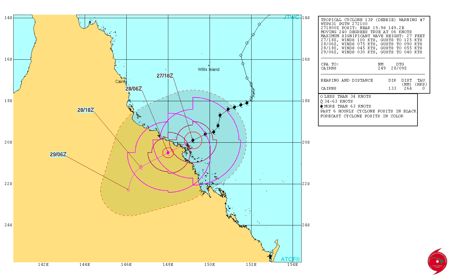
Latest track forecast for tropical cyclone Debbie by the Joint Typhoon Warning Center.